

Previous Story
Greece Updates Covid-19 Risk Map, Measures Change for Some Areas
Posted On 23 Oct 2020
Greece’s Covid-19 risk-assessment map will be updated as of Monday as authorities have announced that the level of risk for a number of regional units have changed.
The risk-assessment map allows citizens to track the spread of the coronavirus (Covid-19) in Greece and stay up to date with the safety measures by regional unit.
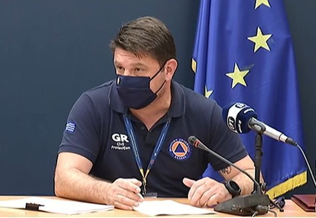
Greek Civil Protection Deputy Minister Nikos Hardalias has informed that from October 26, a total of 25 regional units will be at Level 1-green (from 26, 14 days ago), 33 will be at Level 2-yellow (from 25), 14 will be at Level 3-orange (from 23) and two at Level 4-red (from 0).
“The risk level of a total of 24 of Greece’s 74 regional units will change: 13 have improved and will move down a risk level while, on the contrary, 11 have showed an increase in cases and so they will move up a level,” Hardalis said.
More specifically, from Monday, October 26, Arta, Evros, Ilia, Thesprotia, Kavala and the Sporades will move to Level 2-yellow (monitoring) from Level 1-green (preparedness / on alert). It is noted that in the case of the Sporades, only the island of Skiathos will change level and not Skopelos and Alonissos, which both remain “green”.

Also, the following regional units will move from Level 3-orange (increased monitoring) to Level 2-yellow (monitoring) due to their improved state: Achaia, Heraklion (Crete), Karditsa, Lesvos, Mykonos, Pella and Samos.
As for the islands near Athens, although they belong to the Attica Region, given their distance from the mainland, will move down from Level 3-orange (increased monitoring) to Level 2-yellow (monitoring). It is noted that the risk level of the island of Salamina will remain unchanged due to its frequent transport connection to Piraeus.
Moreover, the regional units of Grevena, Lakonia and Paros will move from Level 2-yellow (monitoring) to Level 1-green (preparedness / on alert).
Further additions to the Level 1-green list (from Level 3-orange) will be the regional units of Zakynthos and Kea – Kythnos.
It is reminded that the regional unit of Kastoria as of Friday, October 23, moved up a risk level on the risk-assessment map to Level 4-red (strict measures) from Level 3-orange and Thessaloniki, Larissa, Serres and Viotia moved from Level 2-yellow (monitoring) to Level 3-orange.
Following are all the regional units per risk level:

Level 1 – Green – Low risk (Intervention: Preparedness / On alert)
Andros, Arcadia, Grevena, Drama, Evritania, Zakynthos, Lakonia, Lassithi, Lefkada, Lemnos, Messinia, Milos, Paros, Thassos, Ithaki, Ikaria, Kalymnos, Karpathos-Kasos, Kea-Kythnos, Kefallonia, Rethymno, Syros, Tinos, Fokida, Chania.
Level 2 – Yellow – Moderate risk (Intervention: Monitoring)
Etoloakarnania, Argolida, Arta, Achaia, Evros, Evia, Ilia, Corinth, Kos, Lesvos, Magnesia, Mykonos, Naxos, Attica Islands (except Salamina, which remains orange), Xanthi, Imathia, Heraklion, Thesprotia, Kavala, Karditsa, Corfu, Kilkis, Pella, Pieria, Preveza, Rodopi, Rhodes, Samos, Sporades (only Skiathos, Skopelos & Alonissos remain green), Fthiotida, Florina, Halkidiki, Chios.
Level 3 – Orange – High risk (Intervention: Increased monitoring)
East Attica, Viotia, North Sector of Athens, West Attica, West Sector of Athens, Larissa, South Sector of Athens, Thessaloniki, Thira (Santorini), Ioannina, Central Sector of Athens, Piraeus, Serres, Trikala.
Level 4 – Red – Very high risk (Intervention: Strict measures)
Kastoria, Kozani.
For ‘orange’ and ‘red’ areas
It is reminded that citizens in all regional units that appear as high risk (levels 3-orange and 4-red) on the country’s risk-assessment map must follow two new measures as of Saturday, October 24:
– wear masks everywhere in public (indoors and outdoors)
– stay indoors between 12:30am and 5:00 am (late night curfew)
The online risk-assessment map is in Greek and updated every 14 days. It can be found here.
The risk level of a regional unit can be found on the map by selecting it from a list, by inserting a postal code, or by pressing on a destination.
Some of the measures that apply to regional areas, according to their risk level, can be found here (in English).


Some enforcement of the CORRECT WEARING OF MASKS on ferries and catamarans seems essential — for crew and passengers alike. Enforcement, not just advice displayed on the tv screen! Round your neck or under your nose is not acceptable. (This comment is based on experience in September.)