
Previous Story
Preservation – Protection Plan for Attica’s Mt Hymettus Tabled
Posted On 27 Jan 2020
Comment: 0
Tag: Association for the Protection and Development of Ymittos (SPAY), Athens environment, Attica environmental initiatives, development of Mt Hymettus, Greece environment, Greece tourism, Greece travel, Greek Environment Ministry, Greek Interior Ministry, Hymettus municipalities, l60809l, Mt Hymettus, preservation projects Attica, Ymittos
Eleven municipalities bordering with Mt Hymettus have tabled a plan for the preservation of the natural habitat and surrounding area to be implemented jointly with the interior and environment ministries.
The Association for the Protection and Development of Ymittos (SPAY) – made up of the Agia Paraskevi, Vari-Voula-Vouliagmeni, Vyronas, Glyfada, Elliniko-Argyroupolis, Zografou, Ilioupolis, Kaisariani, Kropia, Peania, and Papagos-Holargos municipalities – has formulated a plan for the development of the mountain area focusing on preserving the natural habitat and upgrading the surrounding area, making it accessible to residents and at the same time fostering a community support and protection network.

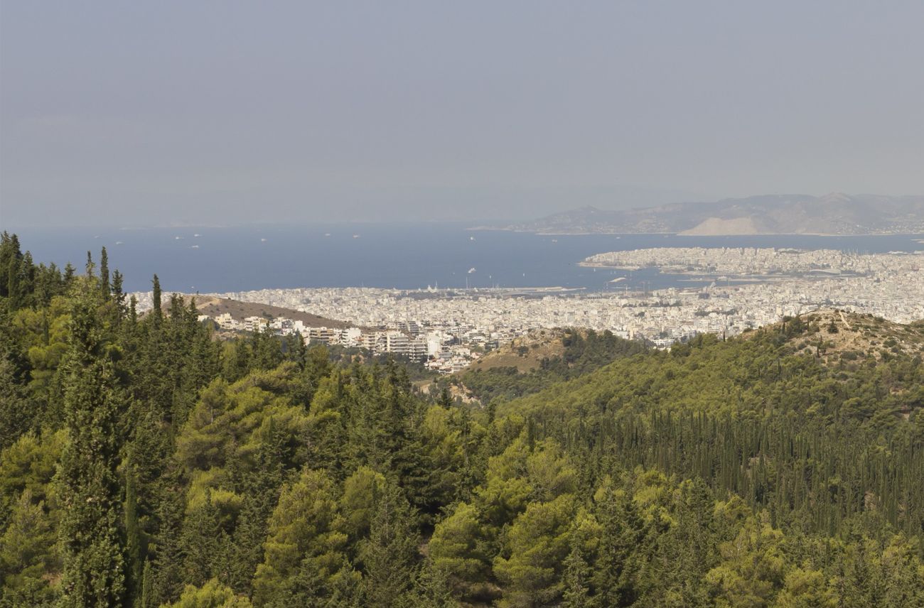
The Hymettus mountain range is located some 8km from central Athens with its highest peak – Evzonas – at an altitude of 1,026m. The mountain area is a popular with hikers and nature lovers.
According to the Athens-Macedonian News Agency, the five-pronged plan focuses on protection and preservation – establishing Hymettus as a recreation point – fostering environmental awareness and highlighting the importance of forests in urban settings – installing crisis control mechanisms ad technologies against fires and floods – cultivating civic responsibility and volunteerism.